Ages of Conflict: World War Simulator

Ages of Conflict: World War Simulator

Not enough ratings
How to Use Images to Convert to Scenarios and Bypass the Map Size Limit
By Titanium Steel
An easier way to create scenarios in Ages of Conflict, and bypass the map size limit!
2
   
Award
Favorite
Favorited
Unfavorite
Opening
Creating scenarios in Ages of Conflict is already possible through the Scenario Editor, but some people prefers to use their image editors instead. Unfortunately, this is not possible through the scenario editor, as importing images for scenarios is not possible, but I have successfully made a solution for this.

I've made a program using python which converts two images to a usable .aoc file that you can paste into your Custom Scenarios folder. Originally, this was supposed to be for personal use, but now I want to share it with the community.

Using my image to .aoc converter, creating scenarios should not only be much easier, it can also bypass the map size limit! For example, here's a 2048x2048 World Map with over 4 million pixels.
https://gtm.steamproxy.vip/sharedfiles/filedetails/?id=3010097115
Download
You can download the program here[github.com]
Steps
Step 1: Download
Download my program through the link above and open it.

Step 2: Terrain file
First, we need to set up a terrain file.
It's quite simple, and all you need is a map that you can get from the Workshop or make one yourself.

Also note that the map size is no longer limited. So you can use a map size above the limit. Do note that doing this will not only increase the time needed to create the .aoc file and increase the file's size, it will take longer to load in game and lag more when you play it!

I have my map of Afro-Eurasia for example, which you can subscribe to here


Step 3: Borders file
This is where we create our nations.
Edit the map to include the nations. They must be a different color, no two nations can have the same color. Use the color FFFFFF for empty land, 0099FF for water/sea, and 000000 for null (never use this).
IMPORTANT NOTES!
  • The aforementioned colors are reserved and cannot be used for nations!
  • It is VERY recommended to color any mountain pixel white, else it will be permanently be the color you gave it! (You can see this error in the 2048x2048 map I made, I did it accidentally)

Here is a borders map for the Afro-Eurasia map for example:


Step 4: Generating the scenario
Now comes the last step, generating the scenario.

1. Open the program, then select the terrain image.
2. Select the borders image.
3. Type the name of the scenario.
4. Click "Generate".


After a few seconds, a .aoc file should appear within the same folder with the program.

Step 5: Importing the .aoc file
This step is quite easy. Simply navigate to "Users\(YOUR USERNAME)\AppData\LocalLow\JoySparkGames\Ages of Conflict\Custom Scenarios" without the quotation marks, then paste the .aoc file in. Then, open Ages of Conflict or restart it if it's already running. The scenario should be in the game.

Step 6: Done!
After this, you're done! The nations will be named their IDs and you must edit them if you want to name them. Also, their capitals will be in random spots, and you must set them too. Other than that, however, your scenario is essentially done.

Here are a few scenarios I created using this method:
https://gtm.steamproxy.vip/sharedfiles/filedetails/?id=3009998323
https://gtm.steamproxy.vip/sharedfiles/filedetails/?id=3009998485
End
If you have any questions or comments regarding this guide please feel free to leave a comment below.

If there's any bugs, report them.

If you create a map with this program, I would really appreciate a credit!

If you have concerns of malware or viruses or your antivirus detected it as a virus, I can assure you it is not a virus. Here is the source code[github.com] (in Python) for the program to check for yourself. You can even run this python version instead, provided you install the required modules first. (PIL and numpy)
27 Comments
weimarer 26 Apr @ 3:30am 
i bypassed puppets
basically i gave a puppet a puppet

1: get a random nation and give them a puppet
2: if the puppet has revolts available, then click the non-established city and click the puppet option
3: BOOM SHAKALAKA
L0maxx 3 Apr @ 3:10pm 
@Robby2710
do win+r to bring up run, type %localappdata% and press OK, then once you're there, look at the location address at the top and go back to appdata, then go to locallow, then to joysparkgames, and you'll be there
solarsystem61 22 Mar @ 11:57pm 
are you gonna update this
mohamadasrimohdali 15 Mar @ 6:55pm 
solarsystem61 why your proflie image like dat
Bagelsir 12 Feb @ 8:38am 
I've made a more up to date guide on how to make scenarios bigger than the size limit. No programs needed other than a photo editor
Kamerad Matto 26 Jan @ 8:07pm 
I was able to make a Fork of this on GitHub to modify this slightly in order to also import the new Forest & Tundra terrains.

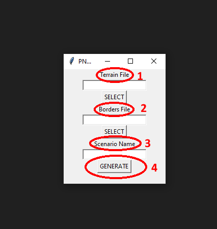
Unfortunately, I don't know how to make it into a .exe like Mr. Steel did, so you'll just need to install Python & PIL & Numpy and download the source code as a .py file and run it if you want to use my forked version. If you don't know how to install Python, PIL, & numpy just ask ChatGPT (that's what I did).
Kamerad Matto 26 Jan @ 11:12am 
@solarsystem61 the reason it makes forests into hills is because the program seems to have been written before the Forest (and Tundra) biomes were added, so it just defaults to the closest color terrain which is Hills (for Forests) or Mountains (for Tundra). You can work around this for the Forests-to-Hills issue by importing your terrain map as just a map in the Custom Maps folder, and then opening it in the in-game scenario editor, just add two cities, and then save it as a scenario. You can then go into the Custom Scenarios folder and open the .aoc file for this temporary scenario with Notepad (or something similar like Notepad++, which may make it easier to parse the information) and copy the terrain information from this temporary scenario that you make that has the correct terrain info, and just paste it over the terrain information from the scenario that the converter makes. That should keep the nation ownership information while overriding the incorrect terrain information.
solarsystem61 25 Jan @ 7:20pm 
why do forests become hills
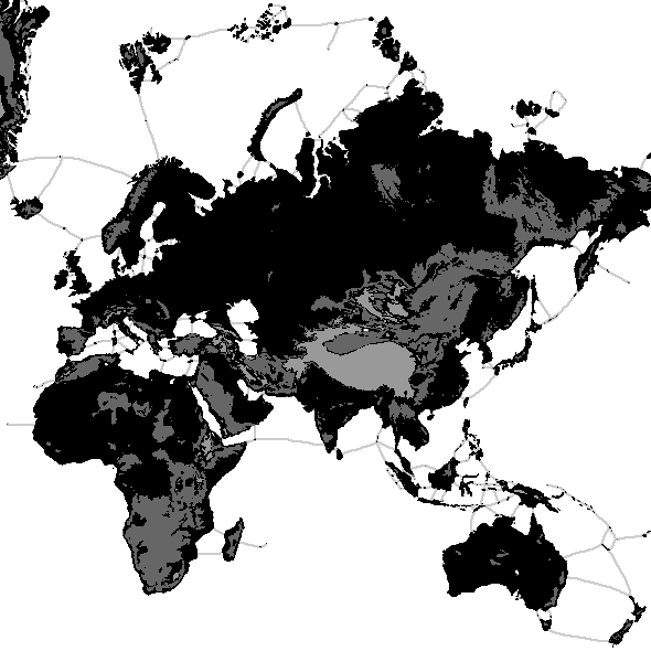
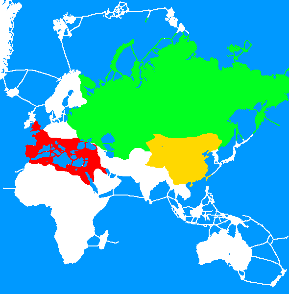
i tested the program out and forests become hills
and it makes my europe map when going through the program look bad
Kamerad Matto 24 Jan @ 7:27am 
Hello Mr. Steel, I am very thankful for your tool, and it has been extremely useful for my scenarios that I have been making. I have noticed however, that since the tool has been released, that two new terrain types have been added that your tool does not seem to account for (Forest terrain, and as of the most recent update, a separate Tundra terrain). It seems that the tool will turn them into the closest color terrain, turning Forest into Hills and Tundra into Mountains. I've been able to work around this by manually modifying the scenario terrain by making a dummy scenario with the desired updated terrain, but was just wondering if you were intending to update your tool to include the newer terrain types.
Once again, thanks tons for making this! It is very useful.
sloth4igirl 4 Dec, 2024 @ 10:01am 
Software written in Python and converted to .exe usually tips off anti-malware services unfairly. Likely false-positive if that's the case. Source also seems clean.